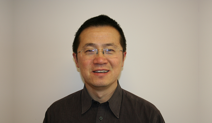
Professor Yong Xue has recently been awarded a Professorship and delivered the inaugural lecture “Big Data in Geocomputation”.
Professor Yong Xue has recently been awarded a Professorship and delivered his inaugural lecture “Big Data in Geocomputation”.
When asked how he reacted when he got the great news, Professor Yong Xue said “I was told that the University is giving me this title in April, and I was very happy! I am excited about my new role and the new possibilities”.
His research focuses on cloud computing and big data research. “We have developed an online platform that provides an online service for quantitative remote sensing community by building the high performance computing facilities,” says Professor Yong Xue.
“An important application of remote sensing is pollution and climate change monitoring, which is also something we are working on,” Professor Yong Xue adds. Professor Yong Xue has an impressive track record of success: 96 papers in peer-reviewed journals, 137 papers in refereed conference proceedings and 23 three PhD students have successfully finished their studies and got their degrees under his supervision.
As the Director of the Informatics Research Centre in our University, he leads the team of nine, has published 10 peer-reviewed journal papers and seven papers in the proceedings of peer-reviewed international conferences. The Centre was awarded an EU/FP7 Collaborative Project “MarcoPolo” and a European Space Agency project “Aerosol_CCI” in 2013.
Find out more about the School of Computing and Digital Media.
Big Data in Geocomputation
Abstract:
Geocomputation is not just using computational techniques to solve spatial problems, but rather a completely new way of doing science in a geographical context. It has impact on understanding the distribution of population, the movement patterns of migratory animals, location of natural resources, crime incidence, the source and areal extent of environmental contamination, the origin and spread of disease, the areal extent of natural disasters, etc.
While high performance computing (HPC) has been a prominent technique to tackle computational issues in Big Data, little work has been done on making HPC adapted to remote sensing applications. The aim of the research team is to develop a collaborative environment “Service-Oriented Remote Sensing Information Service Grid Platform (SORSIS)”. The platform consists of a web portal, a quantitative remote sensing model base and a dynamic quantitative remote sensing processing workflow engine. It will provide one-stop-service for remote sensing applications based on “Grid processing on demand”. In this platform, we intend to demonstrate the usage of HPC for quantitative remote sensing retrieval applications. The novel technologies developed for SORSIS are:
- The SORSIS enables a workflow management system for data placement. A novel architecture for the remote sensing Grid workflow is designed. The remote sensing quantitative retrieval Grid workflow is a high-level core component of the remote sensing Grid, which is used to support the modeling, reconstruction and implementation of large-scale complex applications of remote sensing science.
- The accompanying unified data-and-computation-schedule algorithm helps load balancing between and within workflow steps. A workload estimation and task partition algorithm was developed, and it executes a generic remote sensing algorithm in parallel over partitioned datasets, which is embedded in a middleware framework for the SORSIS.
Short Biography:
Professor Dr. Yong Xue (senior member of IEEE) received a BSc degree in Physics and an MSc degree in remote sensing and GIS from Peking University, China in 1986 and 1989, respectively, and a PhD degree in remote sensing from the University of Dundee, UK. His research focuses on Quantitative Remote Sensing and Geocomputation.
Since 1990, he has published 96 papers in peer-reviewed journals and 137 papers in refereed conference proceedings. One of the publications has been cited over 120 times by scientists around world in their publications. Twenty-three PhD students have successfully finished their study and got their degrees under his supervision. He is one of the key contributors in our University for RAE2008 and REF2014, editor of International Journal of Remote Sensing and International Journal of Digital Earth published by Taylor and Francis, and an invited editor for the special issue on “Geocomputation” for the Future Generation Computer system, published by Elsevier B.V. in October 2004.
Since 2004, he has been the chapter chair of the IEEE U.K. & Republic of Ireland Section Joint Chapter, Aerospace and Electronic Systems Society and Oceanic Engineering Society and Geoscience and Remote Sensing Society.
As the Director of the Informatics Research Centre in our University, he leads the team with nine staff which has published ten peer-reviewed journal papers and seven papers in the proceedings of peer-reviewed international conferences. The Impact Factors of the Journals are as high as 5.298. The Centre was awarded an EU/FP7 Collaborative Project “MarcoPolo” and a European Space Agency project “Aerosol_CCI” in 2013. Two KTP projects have been awarded in 2014.

